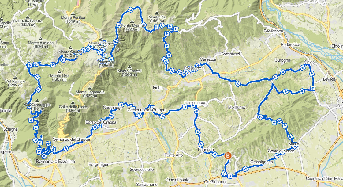
The Route
A 100 km road loop: from the plain of Asolo (~180 m) to the 1,775 m summit of Cima del Monte Grappa, and back. Over 2,600 m of positive elevation gain.
The Climb
You start at ~180 m and climb to the 1,775 m of Cima Grappa, reached around km 55. The heart of the race is here.
Hills, plain
and mountain.
The race is run entirely on paved roads: from the historic centre of Asolo you cross the Asolo hills and the Grappa foothills, then the long climb to the summit begins.
Watch out for the temperature difference: it can range from 35/40°C on the plain to 5°C at the summit. Kit drop points at km 45 and 55 to manage the extreme conditions.
Aid stations, km by km
Aid stations and water points along the 100 km. Distances are approximate. Availability varies based on athlete passage. Bring a portable cup or water bottle.
Kit drop points (highlighted) are at Rifugio Vedetta (~km 44), Cima Grappa (~km 54), Romano d'Ezzelino (~km 80) and Asolo (km 100).
Mountain tips
Foil blanket & warm change
Use the kit drop points at km 45 and 55 for a change to handle the extreme summit conditions.
Cup or water bottle
Portable, to refill at each aid station: the water is for drinking, not wasting.
Variable weather
From 35/40°C on the plain to 5°C at Cima Grappa: prepare for all conditions.